
 Yahoo Finance
 New strategy aims to save sagebrush in Western states

BOISE, Idaho (AP) — A new plan to save sagebrush habitats in Western states that support cattle ranching, recreation and 350 wildlife species — including imperiled sage grouse — is a paradigm shift in strategy, federal officials said.
The 248-page document released this month emphasizes new technologies and analytics as lands managers try to turn around a decades-long losing streak to a devastating combination of invasive plants and wildfires.
The plan categorizes sagebrush areas on their resistance and resiliency to those two threats, and describes a triage system as officials with limited money try to restore and protect sagebrush country where they can.
"A strategic approach to wildland fire and vegetation management is now required that focuses available resources in the places that will maximize conservation return on investment," the document says.
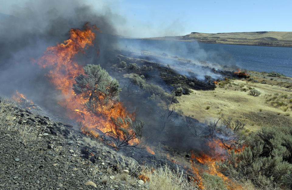
A federal report last year concluded efforts to save sagebrush habitat were failing, with invasive plants such as cheatgrass and medusahead on nearly 160,000 square miles (414,400 sq. kilometers) of public and private lands.
"The problems that are facing the sagebrush steppe are hideous," said Matt Germino, a research ecologist with the U.S. Geological Survey whose work is cited numerous times in the report. "Things haven't been working to everyone's satisfaction."
Failures from past decades include reseeding burned areas at low elevations with sagebrush seeds from high elevations that were from a different subspecies of sagebrush unsuited for warmer, low elevation landscapes.
"A lot of the research in this document revolves around trying to get at the root causes as to why the landscape isn't responding in the predicted ways to the treatment," said Germino, who has studied sagebrush habitats for two decades. He said techniques and mindsets have evolved.
Now, land managers can use geospatial data, maps and genetic information on sagebrush to select the right seeds for the right areas.
A section of the report seeks to make sure there's enough capacity to supply appropriate seeds for restoration efforts following a wildfire.
Giant rangeland wildfires in recent decades have destroyed vast areas of sagebrush steppe. Experts say the wildfires have mainly been driven by warming temperatures and cheatgrass, an invasive species that relies on fire to spread to new areas while killing the native plants, including sagebrush. Once cheatgrass takes over, the land is of little value.
The new strategy says some areas infested with cheatgrass are too far gone. Areas that could especially be targeted for help, the document says, include sagebrush habitat considered key for sage grouse.
Millions of sage grouse, a chicken-sized bird that relies on sagebrush, once roamed the West, but development, livestock grazing and wildfires have reduced its population to fewer than 500,000. The birds are found in 11 states from the Dakotas to California.
The U.S. Fish and Wildlife Service declined to list the bird under the Endangered Species Act in 2015. But there's concern that if wildfires or other factors destroy enough of the sagebrush steppe that remains, the birds could again be considered for listing.
Another part of the report focuses on managing livestock grazing on about 240,000 square miles (621,600 sq. kilometers) of land administered by the Bureau of Land Management, and 148,000 square miles (383,320 sq. kilometers) of U.S Forest Service lands.
Depending on the resilience and resistance to invasive grasses, the document says, grazing can sometimes be used to improve habitat.
Wildfires that burn federal lands with grazing permits typically result in no grazing for several years, which can have a significant financial impact on ranchers.
John Freemuth, a Boise State University environmental policy professor and public lands expert, said politics could play a role in the report's effectiveness. He said that during President Donald Trump's administration, the emphasis has been on oil and gas drilling and less on conserving landscapes.
"If the political directive is toward oil and gas, then you're going to smack into these other issues," Freemuth said. "You really need to be monitoring and watching how the decision makers are using this."
